This final part serves to tie up some loose ends, and to showcase additional trail options and connections in the region. Here, we will go on an alternative route North to the lake, this time on the east side of the river gorge, and check out the parkway and Route 390 trails, which provide us with additional connections. [View this route in Google Earth using this .KMZ file]
The fourth part of the Bike Rochester Series differs quite a bit from the previous ones. We will be venturing on old railroad rights of way (train tracks converted to trails via Rails to Trails Programs). The biggest difference here is that these trails are not paved; they are packed dirt/grass and crushed stone (similar to parts of the unpaved canal trail). So a road bike is not recommended, however a hybrid bike will be more than comfortable and safe. This is the perfect ride to do during the Fall!
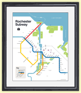
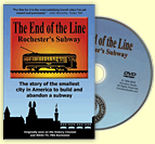
I often get asked if there are tours of the Rochester subway. The short answer is no. The longer answer is while there is no official tour of the “subway,” every October there is usually a tour of the “historic Erie Canal aqueduct.” And it’s coming up this weekend…
In this third piece exhibiting Rochester’s bicycle trails, we will be returning to the Erie Canal Heritage Trail. Click HERE and HERE to see parts one and two, respectively. This time, we will be heading westbound towards Brockport. Although there is not much of a net elevation change between downtown and Brockport, it feels a bit more hilly than the eastbound trail. As we will see, the towns and hamlets we will encounter on this western route have a different character to them than the ones on the eastern trail…
Last week a reader, Michael Krauklis, sent me this picture and asked two perplexing questions. Michael said, “I’ve worked downtown just next to the Broad Street bridge for 11 years now, and the entire time there has been a strange feature in the river just south of the bridge . Upon first glance it appears to be a spring, in the middle of the river, but with further inspection one can see the carcass of an old abandoned structure surrounding it… What was the original purpose of this and where is the water is coming from?”
I have seen these strange concrete triangles in the river myself, and I know there are more than one of them. But I had never noticed the spring water bubbling up! In either case, I had no good answer for Michael. So, I started digging. Here’s what I found out…
Rochester’s old subway tunnel hasn’t seen a passenger car come through here in nearly sixty years. But lately, redevelopment ideas are arriving with unbelievable frequency. A few weeks ago we were talking about the ROC Low Line; an underground park designed by a team of RIT students. This week, another local group has come forward with a different plan. And these guys want to take theirs beyond just an academic study. Stand clear of the yellow line folks – here comes the “Broad Street Underground” concept…
The Ehrmentraut Farm Bridge is easily one of the oldest and most unique bridges in the entire United States, and that kind of distinction is something that piques my interest. There isn’t exactly a ton of information out there on the internet about old bridges on private property, but I’ve managed to piece together its pretty cool history, and then went to check it out myself…
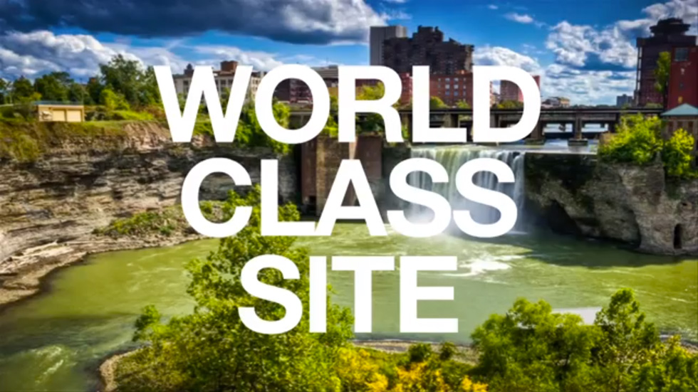
By now you’ve probably heard of the GardenAerial project. But you may not be clear on the details. What is it? And why is it important? Benjamin Woelk is Associate Director of Administration & Community Engagement at GardenAerial. He recently gave a presentation at TEDxFlourCity where he explained how the GardenAerial project will reinvent our community by giving Rochester a “sustainable identity.”
Benjamin reminds us that we have a 96 foot tall waterfall… inside a canyon… in the middle of our city. High Falls has been here for millions of years. Yes it’s evolving; but it’s also been here longer than Kodak, Lilacs or Garbage Plates. Rochester began here. And as he correctly points out, this is a world-class site. Repeat it: A World. Class. Site.
Now watch the video and see how High Falls could be transformed into New York State’s first EcoDistrict, and a boon to our economy once again…
The second part of The Biking in Rochester Series showcases the route from downtown to Lake Ontario, following the Genesee River Trail. It is 20 miles, roundtrip, from downtown to the end of the pier at Lake Ontario Beach Park and back. Actually, I’ll take us a bit further and ride along the lake shore, east to Sea Breeze – adding another 8 miles to the trip.
Although this route is not as consistently scenic as the first one, it has much better rewards, and you get more of a workout. We’ll pass by 3 waterfalls, 3 beaches, 3 lighthouses, and two piers out onto the big lake. The western portion of this route is on the Genesee Riverway trail, a mostly completely dedicated bike path such as the one on the canal. The eastern portion is on King’s highway/Goodman street…
Welcome readers. I’m going on a slight deviation from my usual “Filling In” article to talk about the mean streets of Rochester. Let’s take a look at, eh, Main St. Yeah, Main St. What’s that looks like? Ok, well, there’s some tall(ish) buildings built to the street. There’s sidewalk, theoretically two driving lanes in each direction, and (supposedly) some street trees. If I were to give this street a grade, it would get an “in-complete.”
Oy, how I wish I could reconfigure things! Just pick stuff up and move it around. Maybe add a cycle track or a tree-lined median. Heh heh… can you say, STREET REMIX?!
This is the first in a series of photo tours aimed at encouraging people in the Rochester area—regardless of cycling ability—to get out and enjoy the plethora of trails we have. It is written as an introduction, although most people around here are probably already familiar with some of the trails. Disclaimer: I am not a local… and no where near a veteran cyclist!
Before we begin, I want to point out an advantage Rochester has over some of its upstate neighbors of similar size using Google maps… Buffalo, Rochester, Syracuse/Central NY, Albany/Capital District. Granted, these maps are not 100% accurate. Nor are many of the paths paved. Still it helps give us an idea, in part, why Rochester was named the most bike friendly region in upstate New York (just barely making it on to the top 50 bike friendly cities in the USA ).
For the past few weeks workers have been attacking a 100 ton hunk of slag that was discovered at the Port of Rochester last spring. Yesterday I noticed the giant plume of smoke from the O’rorke Bridge and made my way down to the scene of this epic battle. When the dust settles, who will remain standing? Man? Or The Slag?
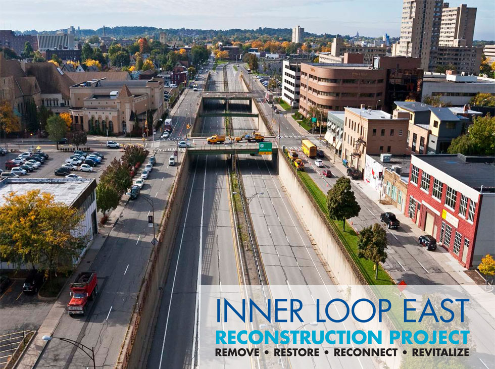
Reconnect Rochester has alerted us to an important informational meeting tonight about the Inner Loop’s future (or lack thereof). As we wait to find out whether or not this project will be a recipient of a USDOT TIGER grant, the City is moving forward with plans to scale down a large portion the underutilized 12-lane highway. Ultimately that will mean greater connectivity between downtown and the neighborhoods to the east, and lower road maintenance costs in the long run. If there was ever a big road project to support, this is it.
Over the years there have been many proposals for the reuse of Rochester’s abandoned subway tunnel. Some would like to see the tunnel preserved and turned into a living museum open to the public. Others would like to turn back the hands of time even further, converting the tunnel back into a water canal – as it was part of the Erie Canal pre-1920s.
Even today as the City continues to take steps towards the latter option, new ideas continue to surface. The most recent concept comes from RIT’s architectural program, and a very interesting student project being called the ROC Low Line…
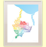
If you’re a RocSubway reader and you love learning about Rochester as much as I do, you might want to check out 585 Magazine. It’s a pretty slick new bimonthly packed with tasty local bits on every topic imaginable. Plus, you might catch an occasional story on local places & history written by yours truly. In the current issue I attempt explore Rochester’s incredible, Olmsted-designed park system – in 800 words or less! Completely impossible, but I tried.
First, head over to 585 Mag and check out the story . Then come back here for fun extras, including Olmsted’s original plan drawings of Highland, Seneca, and Genesee Valley Parks, AND audio from my interview with JoAnn Beck, cochair of the Landmark Society’s Olmsted subcommittee…
If you’ve been following along, you know how we’ve been trying to apply a little design for the betterment of our transit system. First we took a shot at designing a better bus stop sign for Rochester. RGRTA is currently studying that concept in anticipation of one day replacing their existing signs. Next we designed a better bus pass for which RGRTA gave a nod of approval. The new passes will be rolled out very soon!
But wait, there’s more! RGRTA has now asked for help redesigning one of the most important transit tools of all; their big, bad, bus schedules…
WHOA! Not so fast.
It appears RocSubway jumped the gun and accidentally published some information that wasn’t ready for primetime. New bus schedule designs are being worked on, but it will be some time before they are finalized and ready to be shared. If you caught the sneak peek, congrats. And thanks for providing your feedback!
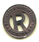
Can you believe it’s been two years since I tried to redesign Rochester’s bus stop signs? Everyone seemed to agree that a makeover was in order – even the folks at RTS who were nice enough to meet with me. But a year later there had been no serious progress on that front. At which point I turned my attention to something else I thought I could improve on; the fare cards. This time I was able to make some real progress…
David DiPonzio, a firefighter with the Lake Shore Fire District in Greece, sent me these photos (taken by friend Fred Amato) of a strange-looking crater in the middle of the parking lot at Ontario Beach Park. An asteroid? Uh, not quite. This may be the most interesting archeological find since RGRTA dug up the RKO Palace. That big rock you see in the center of the crater is actually a giant hunk of slag – left over from the iron or steel mill that once operated here…
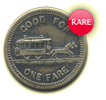
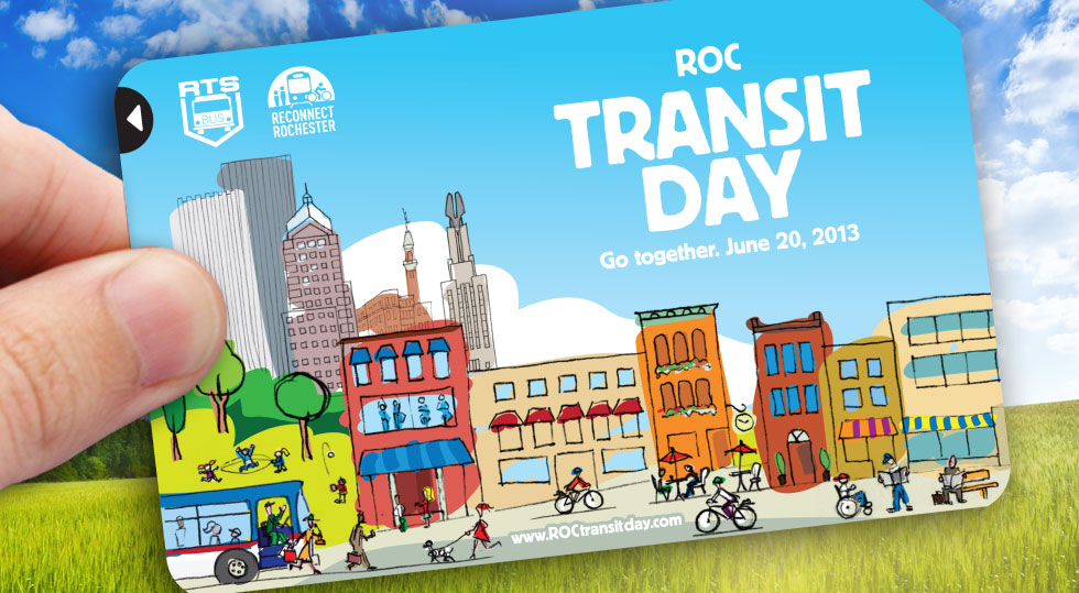
ROC Transit Day is just a week away. About 85 local businesses and organizations have signed up to participate on June 20 – either encouraging their employees & members to leave their cars home, or by offering exclusive deals to transit riders .
Rex the Rhino is planning his bus ride as we speak. Music buskers are tuning up for their performances during the evening rush hour on Main Street. Murphy’s Law on East Avenue is priming the kegs for our happy hour celebration (RSVP here ). And our volunteers are wrapping up HUNDREDS of prizes to deliver to random transit riders.
Get Your Fare Card!
Best of all, we still have 300 limited edition ROC Transit Day fare cards left to give away before the 20th. And we’re making them available to you now – first come first serve. Send us your mailing address and let us know how many fare cards you’d like (no more than 5 per person please). Email your request to [email protected].
We can’t guarantee on time delivery for requests made after Sunday, June 16. So email us now!
The photo above was taken in January, 2011. Late last year we looked at the plans for the new public spaces at Midtown Plaza. Work on the site is now progressing quickly – and those plan drawings are becoming reality. The old Midtown buildings are gone. The new Windstream building is mostly complete. And this week, the first street curbs have been installed giving shape to the new Cortland Street. Here’s a birds-eye view of the past 30 months progress…
Get Email Updates...
Stay up-to-date on Rochester-related stories, artifacts, and ideas that you won't find in the mainstream news.
Totally free, never spammy, and you can unsubscribe at any time.
After the Erie Canal was rerouted south of downtown Rochester, the Rochester
Industrial & Rapid Transit Railway (the “subway”) was built in
its place as a link between the five different railroads and interurban trolley
lines that served the Rochester area. As the industrial landscape of Rochester
changed, and highways replaced the railroads, the Rochester subway gradually
became a relic of a bygone era. In 1956 the subway was abandoned and much of
its route was converted into Interstate 490 — built to connect Rochester
with the New York State Thruway (I-90). Read more about the history of the Rochester Subway.
RochesterSubway.com exists to help spark
public dialogue around how we can better connect the neighborhoods of Rochester
NY, surrounding communities, and their cultural offerings. Rochester’s
future is written in her past. Let's rediscover it.


![The fifth and final part of Ryan Green's Bike Rochester Series... the El Camino and Route 390 Trails! [PHOTO: Ryan Green]](https://www.rochestersubway.com/images/photos/rg-bike-rochester-el-camino-and-route-390-trails-014.jpg)
![The fourth part of the Bike Rochester Series... let's hit the Genesee Greenway and Lehigh Valley Trails! [PHOTO: Ryan Green]](https://www.rochestersubway.com/images/photos/rgbike-rochester-genesee-valley-greenway-lehigh-valley-trail-LV101.jpg)
![A tour of Rochester's abandoned subway tunnel. [PHOTO: RochesterSubway.com]](https://www.rochestersubway.com/images/photos/abandoned_rochester_subway_05.jpg)
![In this third piece exhibiting Rochester's bicycle trails, we will be returning to the Erie Canal Heritage Trail to visit Brockport, NY. [PHOTO: Ryan Green]](https://www.rochestersubway.com/images/photos/rgbike-rochester-to-brockport-B102.jpg)
![I have seen these concrete triangles in the river before. But I had never noticed the spring water bubbling up. What is this strange water feature? [PHOTO: Michael Krauklis]](https://www.rochestersubway.com/images/photos/genesee-river-triangle-rochester.jpg)
![Lewis Childs, co-founder of Broad Street Underground, explains how Rochester's abandoned subway tunnel could be converted into commercial and retail space. [PHOTO: RochesterSubway.com]](https://www.rochestersubway.com/images/photos/rochester-broad-street-underground-01.jpg)
![The Ehrmentraut Farm Bridge is easily one of the oldest and most unique bridges in the entire United States. [PHOTO: Chris Clemens]](https://www.rochestersubway.com/images/photos/ehrmentraut-farm-bridge-01.jpg)
![Turning Point Park boardwalk. [PHOTO: Ryan Green]](https://www.rochestersubway.com/images/photos/rgbike-bike-to-lake-ontario-25-turning-point-park-boardwalk3.jpg)
![The current view looking west down Main Street, Rochester. Blah. If only we could rearrange things. [IMAGE: Google Streetview]](https://www.rochestersubway.com/images/photos/remix-your-street-01b.jpg)
![Ryan Green takes us on a bike ride from downtown Rochester to Fairport. [PHOTO: Ryan Green]](https://www.rochestersubway.com/images/photos/rgbike-erie-canal-path-return-04.jpg)
![The Port of Rochester shrouded in a thick orange haze. Smoke from an epic battle going on right now. [PHOTO: RochesterSubway.com]](https://www.rochestersubway.com/images/photos/slag-button-charlotte-beach-rochester-07.jpg)
![Nine RIT students collaborated to design a subterranean urban park inside the old Rochester subway called the ROC Low Line. [RENDERING: RocLowLine.com]](https://www.rochestersubway.com/images/photos/rochester-lowline-aquaduct.jpg)
![One of the pedestrian bridges in Genesee Valley Park. This was not originally part of Olmsted's plan. [PHOTO: Rochester Public Library, Local History Division]](https://www.rochestersubway.com/images/photos/genesee-valley-park-bridge.jpg)


![Did an asteroid land in the parking lot at Ontario Beach? Not quite. This 100 ton hunk of slag is a remnant from an old steel mill. [PHOTO: Fred Amato]](https://www.rochestersubway.com/images/photos/slag-button-charlotte-beach-rochester-01.jpg)
![Midtown Plaza site, Rochester, NY. [PHOTO: Earthcam.com Archives]](https://www.rochestersubway.com/images/photos/rochester-midtown-plaza-01.jpg)


