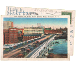
The second part of The Biking in Rochester Series showcases the route from downtown to Lake Ontario, following the Genesee River Trail. It is 20 miles, roundtrip, from downtown to the end of the pier at Lake Ontario Beach Park and back. Actually, I’ll take us a bit further and ride along the lake shore, east to Sea Breeze – adding another 8 miles to the trip.
Although this route is not as consistently scenic as the first one, it has much better rewards, and you get more of a workout. We’ll pass by 3 waterfalls, 3 beaches, 3 lighthouses, and two piers out onto the big lake. The western portion of this route is on the Genesee Riverway trail, a mostly completely dedicated bike path such as the one on the canal. The eastern portion is on King’s highway/Goodman street…
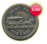
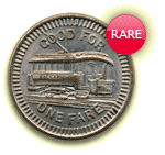
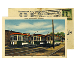
About two months ago I attended a presentation by Matthew Caulfield on the history of Seabreeze Park . Caulfield started working at the park when he was a young twenty-something whippersnapper. At some point he got himself a “real job” at the Library of Congress. Now in his 80’s and retired, he’s back doing what he loves, as the park’s archivist. The following notes and images are just a snippet of his entire presentation which he has assembled over time with the help of his friend Alan Mueller…
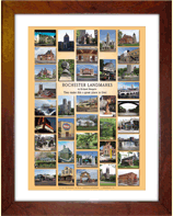
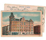
When I first moved to Rochester’s Swillburg neighborhood thirteen years ago, my favorite place to eat was Highland Park Diner. I remember this Rochester Landmarks poster, by Richard Margolis, hung over one of the booths there. I used to stare and study those landmarks all the while shoveling Aunt Bee’s Homestyle Meatloaf into my face. Ah, my first taste of Rochester. Today I own that poster, and I’ve now been to all but one of the 38 landmarks on it. It’s a great feeling!
Now you can get your hands on a copy of this Landmark poster from the RochesterSubway.com Gift Shop, and start checking them off your list too. Can you name all 38 landmarks? No peeking! The answers are after the jump…
Get Email Updates...
Stay up-to-date on Rochester-related stories, artifacts, and ideas that you won't find in the mainstream news.
Totally free, never spammy, and you can unsubscribe at any time.
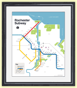
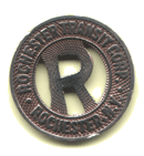
After the Erie Canal was rerouted south of downtown Rochester, the Rochester
Industrial & Rapid Transit Railway (the “subway”) was built in
its place as a link between the five different railroads and interurban trolley
lines that served the Rochester area. As the industrial landscape of Rochester
changed, and highways replaced the railroads, the Rochester subway gradually
became a relic of a bygone era. In 1956 the subway was abandoned and much of
its route was converted into Interstate 490 — built to connect Rochester
with the New York State Thruway (I-90). Read more about the history of the Rochester Subway.
RochesterSubway.com exists to help spark
public dialogue around how we can better connect the neighborhoods of Rochester
NY, surrounding communities, and their cultural offerings. Rochester’s
future is written in her past. Let's rediscover it.


![Turning Point Park boardwalk. [PHOTO: Ryan Green]](https://www.rochestersubway.com/images/photos/rgbike-bike-to-lake-ontario-25-turning-point-park-boardwalk3.jpg)
![Seabreeze Amusement Park. [PHOTO: Courtesy Seabreeze Amusement Park]](https://www.rochestersubway.com/topics/wp-content/uploads/seabreeze-jackrabbit-and-trolley.jpg)
![Rochester Landmarks Poster [IMAGE: Richard Margolis]](https://www.rochestersubway.com/images/photos/rochester-landmarks-poster-richard-margolis.jpg)