[PLEASE NOTE: This was an April Fools posting. Joke’s over.]
RochesterSubway.com has just learned of preliminary plans for what’s being called the Rochester Southern Communities Active Transportation (R-SCAT) project. By building on Monroe County’s original 1947 highway plan, Rochester, Brighton, and Henrietta have agreed to the construction of a new, multimodal connection from downtown Rochester to the New York State Thruway…
This final part serves to tie up some loose ends, and to showcase additional trail options and connections in the region. Here, we will go on an alternative route North to the lake, this time on the east side of the river gorge, and check out the parkway and Route 390 trails, which provide us with additional connections. [View this route in Google Earth using this .KMZ file]
The fourth part of the Bike Rochester Series differs quite a bit from the previous ones. We will be venturing on old railroad rights of way (train tracks converted to trails via Rails to Trails Programs). The biggest difference here is that these trails are not paved; they are packed dirt/grass and crushed stone (similar to parts of the unpaved canal trail). So a road bike is not recommended, however a hybrid bike will be more than comfortable and safe. This is the perfect ride to do during the Fall!
In this third piece exhibiting Rochester’s bicycle trails, we will be returning to the Erie Canal Heritage Trail. Click HERE and HERE to see parts one and two, respectively. This time, we will be heading westbound towards Brockport. Although there is not much of a net elevation change between downtown and Brockport, it feels a bit more hilly than the eastbound trail. As we will see, the towns and hamlets we will encounter on this western route have a different character to them than the ones on the eastern trail…
The second part of The Biking in Rochester Series showcases the route from downtown to Lake Ontario, following the Genesee River Trail. It is 20 miles, roundtrip, from downtown to the end of the pier at Lake Ontario Beach Park and back. Actually, I’ll take us a bit further and ride along the lake shore, east to Sea Breeze – adding another 8 miles to the trip.
Although this route is not as consistently scenic as the first one, it has much better rewards, and you get more of a workout. We’ll pass by 3 waterfalls, 3 beaches, 3 lighthouses, and two piers out onto the big lake. The western portion of this route is on the Genesee Riverway trail, a mostly completely dedicated bike path such as the one on the canal. The eastern portion is on King’s highway/Goodman street…
This is the first in a series of photo tours aimed at encouraging people in the Rochester area—regardless of cycling ability—to get out and enjoy the plethora of trails we have. It is written as an introduction, although most people around here are probably already familiar with some of the trails. Disclaimer: I am not a local… and no where near a veteran cyclist!
Before we begin, I want to point out an advantage Rochester has over some of its upstate neighbors of similar size using Google maps… Buffalo, Rochester, Syracuse/Central NY, Albany/Capital District. Granted, these maps are not 100% accurate. Nor are many of the paths paved. Still it helps give us an idea, in part, why Rochester was named the most bike friendly region in upstate New York (just barely making it on to the top 50 bike friendly cities in the USA ).
Get Email Updates...
Stay up-to-date on Rochester-related stories, artifacts, and ideas that you won't find in the mainstream news.
Totally free, never spammy, and you can unsubscribe at any time.
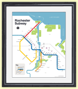
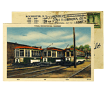
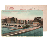
After the Erie Canal was rerouted south of downtown Rochester, the Rochester
Industrial & Rapid Transit Railway (the “subway”) was built in
its place as a link between the five different railroads and interurban trolley
lines that served the Rochester area. As the industrial landscape of Rochester
changed, and highways replaced the railroads, the Rochester subway gradually
became a relic of a bygone era. In 1956 the subway was abandoned and much of
its route was converted into Interstate 490 — built to connect Rochester
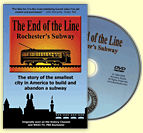
with the New York State Thruway (I-90). Read more about the history of the Rochester Subway.
RochesterSubway.com exists to help spark
public dialogue around how we can better connect the neighborhoods of Rochester
NY, surrounding communities, and their cultural offerings. Rochester’s
future is written in her past. Let's rediscover it.


![The fifth and final part of Ryan Green's Bike Rochester Series... the El Camino and Route 390 Trails! [PHOTO: Ryan Green]](https://www.rochestersubway.com/images/photos/rg-bike-rochester-el-camino-and-route-390-trails-014.jpg)
![The fourth part of the Bike Rochester Series... let's hit the Genesee Greenway and Lehigh Valley Trails! [PHOTO: Ryan Green]](https://www.rochestersubway.com/images/photos/rgbike-rochester-genesee-valley-greenway-lehigh-valley-trail-LV101.jpg)
![In this third piece exhibiting Rochester's bicycle trails, we will be returning to the Erie Canal Heritage Trail to visit Brockport, NY. [PHOTO: Ryan Green]](https://www.rochestersubway.com/images/photos/rgbike-rochester-to-brockport-B102.jpg)
![Turning Point Park boardwalk. [PHOTO: Ryan Green]](https://www.rochestersubway.com/images/photos/rgbike-bike-to-lake-ontario-25-turning-point-park-boardwalk3.jpg)
![Ryan Green takes us on a bike ride from downtown Rochester to Fairport. [PHOTO: Ryan Green]](https://www.rochestersubway.com/images/photos/rgbike-erie-canal-path-return-04.jpg)


