In late October I got the opportunity to go check out a place nearby that I had heard rumors about—a house that has been frozen in a state of construction since 2005. I don’t really feel comfortable sharing the exact location, but the property is in Fairport, NY, out near Egypt on a nice, quiet residential street – surrounded by woods and shrouded in mystery…
This is the first in a series of photo tours aimed at encouraging people in the Rochester area—regardless of cycling ability—to get out and enjoy the plethora of trails we have. It is written as an introduction, although most people around here are probably already familiar with some of the trails. Disclaimer: I am not a local… and no where near a veteran cyclist!
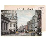
Before we begin, I want to point out an advantage Rochester has over some of its upstate neighbors of similar size using Google maps… Buffalo, Rochester, Syracuse/Central NY, Albany/Capital District. Granted, these maps are not 100% accurate. Nor are many of the paths paved. Still it helps give us an idea, in part, why Rochester was named the most bike friendly region in upstate New York (just barely making it on to the top 50 bike friendly cities in the USA ).
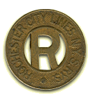
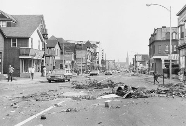
Today marks the 48th anniversary of Rochester’s 1964 “Race Riot” . While doing a little research on the 1964 riot I stumbled upon a completely different (and lesser known) incident. This one could also be called a “race riot” and it occurred 44 years earlier, on the streets of Fairport, NY.
If we’re being 100% honest with each other I have to tell you I used to pee myself with fear at the thought of having to ride Rochester’s bus system. Not because the buses are dirty—they’re actually some of the cleanest buses I’ve ever been in. And no, I’m not afraid of the “people” who ride the bus—some my best friends use RTS to get everywhere they go. I’m ashamed to say I used to avoid taking the bus because I couldn’t read those damn bus schedules. Pathetic I know.
Traveling to and from downtown wasn’t the problem. All I had to do was find a bus stop and hop on—it’s a straight shot. But if I had to get anywhere involving a transfer (which, in Rochester, is pretty much everywhere) then I was lost. How in the world would I know which bus to transfer to once I got downtown? And how long would I have to wait? Would it be quicker to walk? How do I know if this is the most direct route? How much time do I have to leave myself to catch the 7 o’clock show at the Little? AAAAAAH! Forget it! I’ll drive.
Get Email Updates...
Stay up-to-date on Rochester-related stories, artifacts, and ideas that you won't find in the mainstream news.
Totally free, never spammy, and you can unsubscribe at any time.
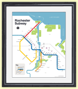
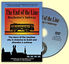
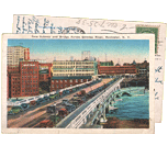
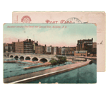
After the Erie Canal was rerouted south of downtown Rochester, the Rochester
Industrial & Rapid Transit Railway (the “subway”) was built in
its place as a link between the five different railroads and interurban trolley
lines that served the Rochester area. As the industrial landscape of Rochester
changed, and highways replaced the railroads, the Rochester subway gradually
became a relic of a bygone era. In 1956 the subway was abandoned and much of
its route was converted into Interstate 490 — built to connect Rochester
with the New York State Thruway (I-90). Read more about the history of the Rochester Subway.
RochesterSubway.com exists to help spark
public dialogue around how we can better connect the neighborhoods of Rochester
NY, surrounding communities, and their cultural offerings. Rochester’s
future is written in her past. Let's rediscover it.


![In late October I got the opportunity to go check out a place nearby that I had heard rumors about—a house that has been frozen in a state of construction since 2005. [PHOTO: Anonymous]](https://www.rochestersubway.com/images/photos/rochester-abandoned-glass-house-01.jpg)
![Ryan Green takes us on a bike ride from downtown Rochester to Fairport. [PHOTO: Ryan Green]](https://www.rochestersubway.com/images/photos/rgbike-erie-canal-path-return-04.jpg)


