Welcome back to our three part series on Charlotte. We’ve arrived at part three. This is it, the omega. If you recall, all the way back in part one, we said this part would be broken up into three sections:
1. Residential and Commercial Development;
2. Transportation; and
3. Governance.
So without further adieu, let’s jump right in. Ok, one quick disclaimer, Charlotte as a whole is pretty big, too big for one little three part column. With that in mind, I’m cutting off Charlotte at Denise Road, similar to the other parts. Maybe someday I can write an addendum addressing the southern portion of the neighborhood. But enough of that – Onward!
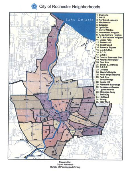
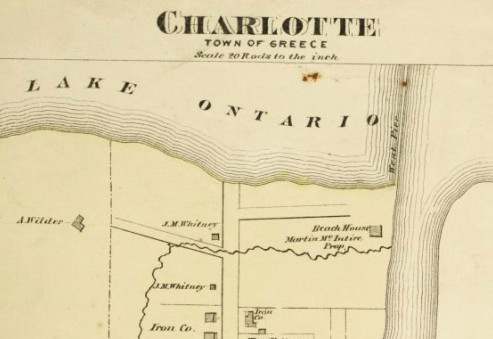
In part one of our three part Charlotte bonanza, we looked briefly at the history of Charlotte, from its formation in 1792, through its resort years and annexation in the early 20th century. In part two, we’ll look at Charlotte as it is today. Let’s start with the lay of the land. Shown above is the official definition of the city’s neighborhoods. As you know, Charlotte is the one at the top. Zooming in (and switching to Google maps) here’s what we see…
Welcome, readers, to the first of a three part series on Charlotte. This first part will serve as an introduction to the series and a brief history of Charlotte. The second part will be a survey, in the engineering sense, of the current state of Charlotte. It will include the demographics of the neighborhood and the built environment, as they exist today. Finally, the third part will layout a vision for Charlotte that works to harness all of the potential of the neighborhood. This final part will be broken into recommendations for residential and commercial development, transportation, and governance.
The plans described here will be ambitious, but we shouldn’t let ourselves shy away from ambition – as you may know, Charlotte has recently been in the news over some redevelopment plans. While Filling-In believes both plans have virtues, they both have numerous weaknesses as well. Because we are unassociated with any of the plans currently in play, and will believe they are built when we see it, the plans presented here will assume they did not happen, and instead will show a different vision of Charlotte’s future.
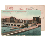
No, the headline isn’t in reference to the recent controversy surrounding the port development. I wanted to take a look back, at the “good ole days,” when Ontario Beach was known as the Coney Island of central and western New York. Here’s a birds eye of view of all the shiny happy fun… The Dentzel carousel. The L.A. Thompson’s Scenic Railway. The Auditorium (a.k.a. the House of Hilarity). Such good times.
Then I noticed the peculiar site of smoke and flames in the background (click the image for a larger view). Holy smokes! Charlotte is burning! Somebody call 9-1-1!!
Ok, so by now you’ve heard all the commotion happening up near the port at Charlotte. The City of Rochester has two development proposals – one with 200 rental apartments, and one with 120 for-sale condos and 50 townhomes. Both would have retail and other mixed use space. But the BIG difference, one looks like Cornhill Landing, while the other would have—deep breath—tall buildings…
Last month RocSubway Facebook fans brought us rumors of a new grocery store for downtown Rochester (those rumors turned out to be true). Now comes an equally exciting rumor from RocSubway that has also checked out. John Tachin, owner of Mr. Dominic’s restaurant in Charlotte has purchased the former Lakeshore Drive-In site and is considering plans to reopen it as a drive in movie theater…
For the past few weeks workers have been attacking a 100 ton hunk of slag that was discovered at the Port of Rochester last spring. Yesterday I noticed the giant plume of smoke from the O’rorke Bridge and made my way down to the scene of this epic battle. When the dust settles, who will remain standing? Man? Or The Slag?
David DiPonzio, a firefighter with the Lake Shore Fire District in Greece, sent me these photos (taken by friend Fred Amato) of a strange-looking crater in the middle of the parking lot at Ontario Beach Park. An asteroid? Uh, not quite. This may be the most interesting archeological find since RGRTA dug up the RKO Palace. That big rock you see in the center of the crater is actually a giant hunk of slag – left over from the iron or steel mill that once operated here…
There are several insanely awesome events going on this weekend from the East End Fest to the Rally for Roc City Skate Park at High Falls. All very worthy and worthwhile. But there’s one that deserves a mention because of what it represents for our community.
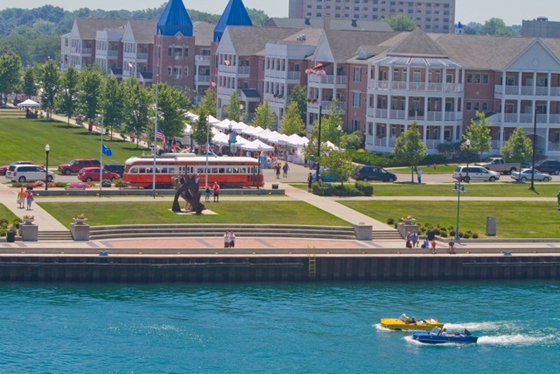
Bill Moran of WCMF has set up a last minute family picnic and concert at Charlotte Beach to answer the beach park brawl that took place there last weekend on Memorial Day. The idea for Bill Moran came after the fights at Ontario Beach Park Monday night and the calls he got from his listeners. “One that stuck in my head is a guy that lives on Latta Road. This is his back yard and he said I’d rather drive 40 minutes to Sodus than come here. Let’s not be bullied out of here. The sum of our families is greater than the people who make bad decisions.”
He’s calling it “Rockin’ the Beach” — a park-wide picnic with lives bands and face painting for kids. See the event details on Facebook and RSVP to let your friends know you’ll be there.
If I said Rochester may one day have a rapid transportation system linking RIT to downtown Rochester and beyond, you might automatically think ‘light rail’. Think again. RochesterSubway.com recently discussed the future of Rochester’s transportation infrastructure with Richard Perrin, Executive Director of the Genesee Transportation Council and an AICP certified city planner.
NOTE: If you’ve got a question that we didn’t ask in our interview, please leave a comment at the end of this post and we’ll pass it along to Mr. Perrin who will do his best to answer it as time permits.
Get Email Updates...
Stay up-to-date on Rochester-related stories, artifacts, and ideas that you won't find in the mainstream news.
Totally free, never spammy, and you can unsubscribe at any time.
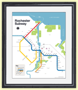
After the Erie Canal was rerouted south of downtown Rochester, the Rochester
Industrial & Rapid Transit Railway (the “subway”) was built in
its place as a link between the five different railroads and interurban trolley
lines that served the Rochester area. As the industrial landscape of Rochester
changed, and highways replaced the railroads, the Rochester subway gradually
became a relic of a bygone era. In 1956 the subway was abandoned and much of
its route was converted into Interstate 490 — built to connect Rochester
with the New York State Thruway (I-90). Read more about the history of the Rochester Subway.
RochesterSubway.com exists to help spark
public dialogue around how we can better connect the neighborhoods of Rochester
NY, surrounding communities, and their cultural offerings. Rochester’s
future is written in her past. Let's rediscover it.


![The marquee sign at the former Lakeshore Drive-in Theatre in Greece, NY. [PHOTO: NewYorkDriveIns.com]](https://www.rochestersubway.com/images/photos/rochester-lakeshore-drive-in-movie-theater-marquee.jpg)
![The Port of Rochester shrouded in a thick orange haze. Smoke from an epic battle going on right now. [PHOTO: RochesterSubway.com]](https://www.rochestersubway.com/images/photos/slag-button-charlotte-beach-rochester-07.jpg)
![Did an asteroid land in the parking lot at Ontario Beach? Not quite. This 100 ton hunk of slag is a remnant from an old steel mill. [PHOTO: Fred Amato]](https://www.rochestersubway.com/images/photos/slag-button-charlotte-beach-rochester-01.jpg)
![Bill Moran of WCMF has set up a last minute family picnic and concert at Charlotte Beach to answer the beach park brawl that took place there last weekend on Memorial Day. We need all hands on deck to come out show support for one of Rochester's most well loved assets. [FLICKR PHOTO: jimmywayne]](https://www.rochestersubway.com/images/photos/rochester-ontario-beach-park.jpg)