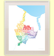
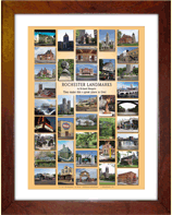
A new collaborative art exhibit will open Sunday, May 11, at ARTISANworks . “Rochester (& Other) Landmarks” features the work of local photographer, Jonathan White, and graffiti artist, Antonio “Chico” Garcia.
To the average viewer the work may come across as a bit of a train wreck; seemingly random doodles, awkwardly juxtaposed against a familiar urban landscape. But like any good wreck, once it catches your eye, you’ll find it impossible to look away…
No, the headline isn’t in reference to the recent controversy surrounding the port development. I wanted to take a look back, at the “good ole days,” when Ontario Beach was known as the Coney Island of central and western New York. Here’s a birds eye of view of all the shiny happy fun… The Dentzel carousel. The L.A. Thompson’s Scenic Railway. The Auditorium (a.k.a. the House of Hilarity). Such good times.
Then I noticed the peculiar site of smoke and flames in the background (click the image for a larger view). Holy smokes! Charlotte is burning! Somebody call 9-1-1!!
The Rochesterian has blogged several times about the need to create a link between Frontier Field and Sahlen’s Stadium… and how Rochester needs someone like Buffalo Sabres owner Terry Pegula to invest in a Harbor Center type of development centered around Rochester’s sports arenas. I don’t disagree. Rochester’s stadiums (and the neighborhoods around them) could, and should be a much bigger draw.
Last April a local businessman named Jerry DeCarolis sent me a concept plan he put together called “Stadiumville.” I was impressed. But this plan was so ambitious, and so broad-sweeping, I wasn’t quite sure how seriously to take it. And so I ended up sitting on the document – until now…
If you’re a true Rochesterian you’ve probably taken many trips to Donuts Delite. And if you’ve sat in the dining room (and looked down past your doughnut-filled belly) you may have noticed a cute little milkmaid hauling her yoke and buckets full of milk across the floor.
I was curious to know how she got there and what her significance was. Of course I know milk is an ingredient in doughnuts, but it just seemed like an odd symbol to be used to represent doughnuts. There must be a story behind it…
Local balloon artists Larry Moss and Kelly Cheatle are hard at work right now constructing an enormous, 5-story tall beanstalk entirely out of balloons in the atrium of Rochester’s landmark Sibley Building.
Unlike previous haunted “Balloon Manors” you may remember at area shopping malls, admission is completely free for the public to come and enjoy this one. Balloon Manor: The VERY Tall Tale of Jack and his Beanstalk is due to be completed today, and open for viewing thru Sunday, February 9…
Walter has been a fixture at local sporting events and concerts for decades. Known to most Rochesterians as “The Accordion Man,” Walter plays his squeezebox (and sings) outside most hockey, basketball and lacrosse games… at music events all around the city… and of course, a Redwings game would not be the same without Walter’s rendition of Take Me Out To The Ballgame playing in the background as fans line up at the turnstiles.
In a recent phone conversation with him, Walter told me he’s been playing around Rochester for three decades. He’s missed only one game in the past 15 years. And he’s gone through 83 accordions. His latest one is currently out of commission with broken keys and a worn strap…
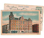
This former department store (Sibley, Lindsay & Curr Company) is truly massive. Rochester’s Sibley Building weighs in at over 1.1 million square feet (23 acres of floorspace) – easily the largest building in Monroe County.
WinnCompanies out of Boston now owns the property and plans to spend up to $200 Million over the next five years to bring it back to life as mixed-use space. Holy smokes, do these guys have their work cut out for them. You may have noticed new windows and awnings along Main Street? Some 2,000 windows have yet to be replaced.
Last week the UofR Urban Explorers Club went on a tour through the maze of hallways and spaces, from the dark sub-basement all the way up to the two massive water tanks on the tower rooftop…
Durand-Eastman Park. So peaceful and picturesque. This time of year the autumn colors are brilliant. And the water is so calm and reflective; the landscape seems to gently float up into the sky. This could be heaven.
On the edge of one great Lake Ontario, two much smaller lakes, Durand and Eastman are named for the two men who donated the land for this beautiful park. In the early 1900’s Dr. Henry S. Durand owned a summer camp here. He and his friend George Eastman saw a need for a public park with access to the beach. So they bought a number of farms around the Durand property, and in 1907 they offered the land to the City of Rochester.
But to willingly give away this place, I have to believe Dr. Durand knew contained something that was not quite right. Maybe something terrifying…
This final part serves to tie up some loose ends, and to showcase additional trail options and connections in the region. Here, we will go on an alternative route North to the lake, this time on the east side of the river gorge, and check out the parkway and Route 390 trails, which provide us with additional connections. [View this route in Google Earth using this .KMZ file]
If you’re like me, and you enjoy exploring local places most people overlook, here’s a neat project you might want to support. Benjamin Woelk (30, Rochester) and Jason Darnieder (Flower City Media) are working on a documentary travel series that focuses on exploring upstate and western N.Y. He’s calling the project “Slow Road” – a documentary series dedicated to sustaining community, preserving the past, and exploring America’s roads less traveled…
The fourth part of the Bike Rochester Series differs quite a bit from the previous ones. We will be venturing on old railroad rights of way (train tracks converted to trails via Rails to Trails Programs). The biggest difference here is that these trails are not paved; they are packed dirt/grass and crushed stone (similar to parts of the unpaved canal trail). So a road bike is not recommended, however a hybrid bike will be more than comfortable and safe. This is the perfect ride to do during the Fall!
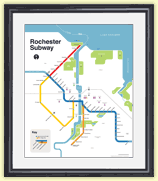
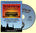
I often get asked if there are tours of the Rochester subway. The short answer is no. The longer answer is while there is no official tour of the “subway,” every October there is usually a tour of the “historic Erie Canal aqueduct.” And it’s coming up this weekend…
Within a 30 minute drive of downtown Rochester, beyond the suburban development surrounding the city, is the Village of Honeoye Falls. Honeoye Falls is not a typical crossroads village though. Like Rochester, it was settled due to the location of the waterfalls to provide power to mills in the early 1800s. Unlike Rochester though, it never grew large enough to lose the majority of its Main Street to large suburban plazas, malls, and ‘big boxes’.
Dunkin’ Donuts is interested in constructing a new location with a drive-thru, in a section of the village which currently has a small concentration of commercial development, but the village code currently disallows drive-thru restaurants. The Mayor and some members of the Village Board are supporting a proposal to change the code to allow Dunkin’ Donuts to build a drive-thru even though the village is in the midst of updating the Comprehensive Plan. Convenience and an additional source of revenue for the village government may come at a high cost though if a drive-thru is allowed…
In this third piece exhibiting Rochester’s bicycle trails, we will be returning to the Erie Canal Heritage Trail. Click HERE and HERE to see parts one and two, respectively. This time, we will be heading westbound towards Brockport. Although there is not much of a net elevation change between downtown and Brockport, it feels a bit more hilly than the eastbound trail. As we will see, the towns and hamlets we will encounter on this western route have a different character to them than the ones on the eastern trail…
Rochester’s old subway tunnel hasn’t seen a passenger car come through here in nearly sixty years. But lately, redevelopment ideas are arriving with unbelievable frequency. A few weeks ago we were talking about the ROC Low Line; an underground park designed by a team of RIT students. This week, another local group has come forward with a different plan. And these guys want to take theirs beyond just an academic study. Stand clear of the yellow line folks – here comes the “Broad Street Underground” concept…
The Ehrmentraut Farm Bridge is easily one of the oldest and most unique bridges in the entire United States, and that kind of distinction is something that piques my interest. There isn’t exactly a ton of information out there on the internet about old bridges on private property, but I’ve managed to piece together its pretty cool history, and then went to check it out myself…
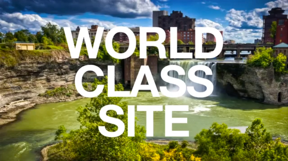
By now you’ve probably heard of the GardenAerial project. But you may not be clear on the details. What is it? And why is it important? Benjamin Woelk is Associate Director of Administration & Community Engagement at GardenAerial. He recently gave a presentation at TEDxFlourCity where he explained how the GardenAerial project will reinvent our community by giving Rochester a “sustainable identity.”
Benjamin reminds us that we have a 96 foot tall waterfall… inside a canyon… in the middle of our city. High Falls has been here for millions of years. Yes it’s evolving; but it’s also been here longer than Kodak, Lilacs or Garbage Plates. Rochester began here. And as he correctly points out, this is a world-class site. Repeat it: A World. Class. Site.
Now watch the video and see how High Falls could be transformed into New York State’s first EcoDistrict, and a boon to our economy once again…
The second part of The Biking in Rochester Series showcases the route from downtown to Lake Ontario, following the Genesee River Trail. It is 20 miles, roundtrip, from downtown to the end of the pier at Lake Ontario Beach Park and back. Actually, I’ll take us a bit further and ride along the lake shore, east to Sea Breeze – adding another 8 miles to the trip.
Although this route is not as consistently scenic as the first one, it has much better rewards, and you get more of a workout. We’ll pass by 3 waterfalls, 3 beaches, 3 lighthouses, and two piers out onto the big lake. The western portion of this route is on the Genesee Riverway trail, a mostly completely dedicated bike path such as the one on the canal. The eastern portion is on King’s highway/Goodman street…
This is the first in a series of photo tours aimed at encouraging people in the Rochester area—regardless of cycling ability—to get out and enjoy the plethora of trails we have. It is written as an introduction, although most people around here are probably already familiar with some of the trails. Disclaimer: I am not a local… and no where near a veteran cyclist!
Before we begin, I want to point out an advantage Rochester has over some of its upstate neighbors of similar size using Google maps… Buffalo, Rochester, Syracuse/Central NY, Albany/Capital District. Granted, these maps are not 100% accurate. Nor are many of the paths paved. Still it helps give us an idea, in part, why Rochester was named the most bike friendly region in upstate New York (just barely making it on to the top 50 bike friendly cities in the USA ).
In just its third year the Greentopia Film Festival (September 10-15th) has grown to become the second largest documentary film festival in New York State. Filmmakers’ submissions to the 2013 event were triple the number of those received in 2012, coming in from 31 countries on six continents. Of those films selected as features, four will have their New York State premieres at Greentopia – revealing themselves to Rochester audiences even before New York City moviegoers can see them…
Get Email Updates...
Stay up-to-date on Rochester-related stories, artifacts, and ideas that you won't find in the mainstream news.
Totally free, never spammy, and you can unsubscribe at any time.
After the Erie Canal was rerouted south of downtown Rochester, the Rochester
Industrial & Rapid Transit Railway (the “subway”) was built in
its place as a link between the five different railroads and interurban trolley
lines that served the Rochester area. As the industrial landscape of Rochester
changed, and highways replaced the railroads, the Rochester subway gradually
became a relic of a bygone era. In 1956 the subway was abandoned and much of
its route was converted into Interstate 490 — built to connect Rochester
with the New York State Thruway (I-90). Read more about the history of the Rochester Subway.
RochesterSubway.com exists to help spark
public dialogue around how we can better connect the neighborhoods of Rochester
NY, surrounding communities, and their cultural offerings. Rochester’s
future is written in her past. Let's rediscover it.


![Rochester (& Other) Landmarks' is a collaboration between local photographer Jonathan White, and NYC graffiti artist Antonio 'Chico' Garcia. [IMAGE: Used with permission from the artists]](https://www.rochestersubway.com/images/photos/rochester-other-landmarks-by-chico-and-white-04.jpg)


![An Art-Deco style milkmaid is depicted in the floor of Donuts Delite, Rochester NY. [PHOTO: RochesterSubway.com]](https://www.rochestersubway.com/images/photos/donuts-delite-milkmaid-rochester.jpg)
!['Balloon Manor: The Very Tall Tale of Jack & His Beanstalk' at the Sibley Building, Rochester, NY. [PHOTO: RochesterSubway.com]](https://www.rochestersubway.com/images/photos/jack-and-the-beanstalk-balloon-sculpture-00.jpg)
![Walter, Rochester's accordion man, performing underneath the Freddie-Sue bridge in Corn Hill as a crowd gathers for the Eddie Money 'Party in the Park' concert [PHOTO: Jeff Gerew, C7Photo.com]](https://www.rochestersubway.com/images/photos/rochester-accordion-man-walter-palmer-01.jpg)
![The Sibley Building, Rochester NY. [PHOTO: RochesterSubway.com]](https://www.rochestersubway.com/images/photos/rochester-sibley-building-01.jpg)
![Durand-Eastman Park, Rochester, NY. [PHOTO: RochesterSubway.com]](https://www.rochestersubway.com/images/photos/rochester-durand-eastman-park-01.jpg)
![The fifth and final part of Ryan Green's Bike Rochester Series... the El Camino and Route 390 Trails! [PHOTO: Ryan Green]](https://www.rochestersubway.com/images/photos/rg-bike-rochester-el-camino-and-route-390-trails-014.jpg)
![Benjamin Woelk wants to produce a grassroots travel documentary series called 'Slow Road.' [PHOTO: Provided]](https://www.rochestersubway.com/images/photos/benjamin-woelk-slow-road-01.jpg)
![The fourth part of the Bike Rochester Series... let's hit the Genesee Greenway and Lehigh Valley Trails! [PHOTO: Ryan Green]](https://www.rochestersubway.com/images/photos/rgbike-rochester-genesee-valley-greenway-lehigh-valley-trail-LV101.jpg)
![A tour of Rochester's abandoned subway tunnel. [PHOTO: RochesterSubway.com]](https://www.rochestersubway.com/images/photos/abandoned_rochester_subway_05.jpg)

![In this third piece exhibiting Rochester's bicycle trails, we will be returning to the Erie Canal Heritage Trail to visit Brockport, NY. [PHOTO: Ryan Green]](https://www.rochestersubway.com/images/photos/rgbike-rochester-to-brockport-B102.jpg)
![Lewis Childs, co-founder of Broad Street Underground, explains how Rochester's abandoned subway tunnel could be converted into commercial and retail space. [PHOTO: RochesterSubway.com]](https://www.rochestersubway.com/images/photos/rochester-broad-street-underground-01.jpg)
![The Ehrmentraut Farm Bridge is easily one of the oldest and most unique bridges in the entire United States. [PHOTO: Chris Clemens]](https://www.rochestersubway.com/images/photos/ehrmentraut-farm-bridge-01.jpg)
![Turning Point Park boardwalk. [PHOTO: Ryan Green]](https://www.rochestersubway.com/images/photos/rgbike-bike-to-lake-ontario-25-turning-point-park-boardwalk3.jpg)
![Ryan Green takes us on a bike ride from downtown Rochester to Fairport. [PHOTO: Ryan Green]](https://www.rochestersubway.com/images/photos/rgbike-erie-canal-path-return-04.jpg)
![This year's Greentopia Film Festival will feature an array of unique films and equally unique screening locations; such as the roof of 1 Capron Street. [PHOTO: Jason Schwingle, TheRochesteriat.com]](https://www.rochestersubway.com/images/photos/greentopia-2013-rooftop-screening.jpg)


