In this third piece exhibiting Rochester’s bicycle trails, we will be returning to the Erie Canal Heritage Trail. Click HERE and HERE to see parts one and two, respectively. This time, we will be heading westbound towards Brockport. Although there is not much of a net elevation change between downtown and Brockport, it feels a bit more hilly than the eastbound trail. As we will see, the towns and hamlets we will encounter on this western route have a different character to them than the ones on the eastern trail…
Last week a reader, Michael Krauklis, sent me this picture and asked two perplexing questions. Michael said, “I’ve worked downtown just next to the Broad Street bridge for 11 years now, and the entire time there has been a strange feature in the river just south of the bridge . Upon first glance it appears to be a spring, in the middle of the river, but with further inspection one can see the carcass of an old abandoned structure surrounding it… What was the original purpose of this and where is the water is coming from?”
I have seen these strange concrete triangles in the river myself, and I know there are more than one of them. But I had never noticed the spring water bubbling up! In either case, I had no good answer for Michael. So, I started digging. Here’s what I found out…
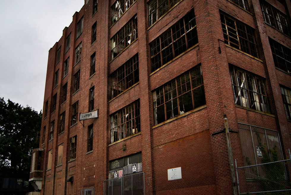
If you’ve ever driven down the eastern end of Lyell Ave., or been to a soccer game at Sahlen’s Stadium, you’ve probably seen an enormous old shell of a building looming in the distance. Many times I had seen it’s old edifice sitting silent and, as I usually do, I wondered what the walls contained, what stories it could tell, and what it once was. That’s why one cool September morning I went to meet with the building and see what it could tell me…
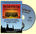
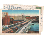
Rochester’s old subway tunnel hasn’t seen a passenger car come through here in nearly sixty years. But lately, redevelopment ideas are arriving with unbelievable frequency. A few weeks ago we were talking about the ROC Low Line; an underground park designed by a team of RIT students. This week, another local group has come forward with a different plan. And these guys want to take theirs beyond just an academic study. Stand clear of the yellow line folks – here comes the “Broad Street Underground” concept…
My friend over at RocPX.com snapped this photo in the men’s room at the Rochester Public Market. Now, I know Rachel Barnhart and I consider her a good friend. So I really don’t want to spread rumors… NAAAH! That’s what the internet is for. Here’s what it says..
The Ehrmentraut Farm Bridge is easily one of the oldest and most unique bridges in the entire United States, and that kind of distinction is something that piques my interest. There isn’t exactly a ton of information out there on the internet about old bridges on private property, but I’ve managed to piece together its pretty cool history, and then went to check it out myself…
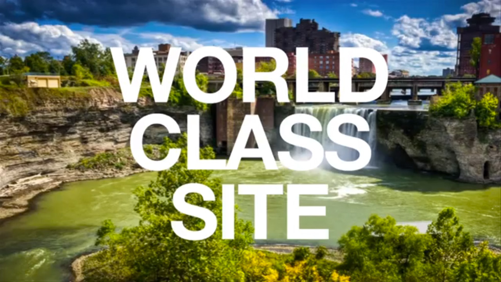
By now you’ve probably heard of the GardenAerial project. But you may not be clear on the details. What is it? And why is it important? Benjamin Woelk is Associate Director of Administration & Community Engagement at GardenAerial. He recently gave a presentation at TEDxFlourCity where he explained how the GardenAerial project will reinvent our community by giving Rochester a “sustainable identity.”
Benjamin reminds us that we have a 96 foot tall waterfall… inside a canyon… in the middle of our city. High Falls has been here for millions of years. Yes it’s evolving; but it’s also been here longer than Kodak, Lilacs or Garbage Plates. Rochester began here. And as he correctly points out, this is a world-class site. Repeat it: A World. Class. Site.
Now watch the video and see how High Falls could be transformed into New York State’s first EcoDistrict, and a boon to our economy once again…
What could be more fun than a barrel of monkeys? How about one filled with the body parts of a Rochester mobster? Yeah, I thought so. Ok, so here’s the story…
I happened to be walking by Eastman Business Park this week when I noticed workers messing with the big Kodak sign. My heart of skipped a beat as my first thought was, they must be taking the sign down. I know it’s just a sign. But it’s also part of our collective story. I’d be disappointed to see it go. So I stopped and asked one of the guys if this was the case…
In what’s being called one of Rochester’s biggest election upsets, City Council President Lovely Warren handed Mayor Tom Richards his hat in this week’s Democratic primary for mayor.
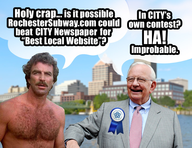
In another, unrelated election race, Rochesterians are now asking if RochesterSubway.com has any shot of upsetting CITY Newspaper for Best Local Website of 2013 in CITY Newspaper’s own “Best Of” contest (on line #74).
Spoiler alert: The answer is NO! — N… O.
I mean, come on! It’s CITY’s own contest. This ain’t no mayoral race.
Rochester has a number of famous people buried within its cemeteries, but Francis Tumblety (spelled: “Tumuelty” on the grave stone because Francis’ parents changed it) is probably one of the few infamous people to rest in peace, right in the historic Holy Sepulchre Cemetery on Lake Ave. Known for a number of his high profile arrests, Tumblety’s name has been cleared numerous times of various committed atrocities, but the stigma associated with his sordid lifestyle and relationships has managed to remain his legacy…
The second part of The Biking in Rochester Series showcases the route from downtown to Lake Ontario, following the Genesee River Trail. It is 20 miles, roundtrip, from downtown to the end of the pier at Lake Ontario Beach Park and back. Actually, I’ll take us a bit further and ride along the lake shore, east to Sea Breeze – adding another 8 miles to the trip.
Although this route is not as consistently scenic as the first one, it has much better rewards, and you get more of a workout. We’ll pass by 3 waterfalls, 3 beaches, 3 lighthouses, and two piers out onto the big lake. The western portion of this route is on the Genesee Riverway trail, a mostly completely dedicated bike path such as the one on the canal. The eastern portion is on King’s highway/Goodman street…
Welcome readers. I’m going on a slight deviation from my usual “Filling In” article to talk about the mean streets of Rochester. Let’s take a look at, eh, Main St. Yeah, Main St. What’s that looks like? Ok, well, there’s some tall(ish) buildings built to the street. There’s sidewalk, theoretically two driving lanes in each direction, and (supposedly) some street trees. If I were to give this street a grade, it would get an “in-complete.”
Oy, how I wish I could reconfigure things! Just pick stuff up and move it around. Maybe add a cycle track or a tree-lined median. Heh heh… can you say, STREET REMIX?!
This is the first in a series of photo tours aimed at encouraging people in the Rochester area—regardless of cycling ability—to get out and enjoy the plethora of trails we have. It is written as an introduction, although most people around here are probably already familiar with some of the trails. Disclaimer: I am not a local… and no where near a veteran cyclist!
Before we begin, I want to point out an advantage Rochester has over some of its upstate neighbors of similar size using Google maps… Buffalo, Rochester, Syracuse/Central NY, Albany/Capital District. Granted, these maps are not 100% accurate. Nor are many of the paths paved. Still it helps give us an idea, in part, why Rochester was named the most bike friendly region in upstate New York (just barely making it on to the top 50 bike friendly cities in the USA ).
Get Email Updates...
Stay up-to-date on Rochester-related stories, artifacts, and ideas that you won't find in the mainstream news.
Totally free, never spammy, and you can unsubscribe at any time.
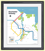
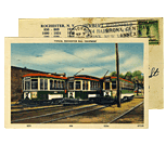
After the Erie Canal was rerouted south of downtown Rochester, the Rochester
Industrial & Rapid Transit Railway (the “subway”) was built in
its place as a link between the five different railroads and interurban trolley
lines that served the Rochester area. As the industrial landscape of Rochester
changed, and highways replaced the railroads, the Rochester subway gradually
became a relic of a bygone era. In 1956 the subway was abandoned and much of
its route was converted into Interstate 490 — built to connect Rochester
with the New York State Thruway (I-90). Read more about the history of the Rochester Subway.
RochesterSubway.com exists to help spark
public dialogue around how we can better connect the neighborhoods of Rochester
NY, surrounding communities, and their cultural offerings. Rochester’s
future is written in her past. Let's rediscover it.


![In this third piece exhibiting Rochester's bicycle trails, we will be returning to the Erie Canal Heritage Trail to visit Brockport, NY. [PHOTO: Ryan Green]](https://www.rochestersubway.com/images/photos/rgbike-rochester-to-brockport-B102.jpg)
![I have seen these concrete triangles in the river before. But I had never noticed the spring water bubbling up. What is this strange water feature? [PHOTO: Michael Krauklis]](https://www.rochestersubway.com/images/photos/genesee-river-triangle-rochester.jpg)
![Lewis Childs, co-founder of Broad Street Underground, explains how Rochester's abandoned subway tunnel could be converted into commercial and retail space. [PHOTO: RochesterSubway.com]](https://www.rochestersubway.com/images/photos/rochester-broad-street-underground-01.jpg)
![Writing on the wall of the men's room at the Rochester Public Market. [PHOTO: RocPX.com]](https://www.rochestersubway.com/images/photos/rachbarnhart-gives-good-tweet-censored.jpg)
![The Ehrmentraut Farm Bridge is easily one of the oldest and most unique bridges in the entire United States. [PHOTO: Chris Clemens]](https://www.rochestersubway.com/images/photos/ehrmentraut-farm-bridge-01.jpg)
![A whiskey barrel lies among the shrubs and fallen leaves in a Webster gully. This close-up photograph, showing cloth in the top of the barrel, was taken before the dismembered body of Francesco Manzello had been removed from the barrel. [PHOTO: Albert R. Stone]](https://www.rochestersubway.com/images/photos/rochester-mafia-barrel-murder-01.jpg)

![Grave of Francis Tumblety at Holy Sepulchre Cemetery. [PHOTO: Chris Clemens]](https://www.rochestersubway.com/images/photos/francis-tumblety-01.jpg)
![Turning Point Park boardwalk. [PHOTO: Ryan Green]](https://www.rochestersubway.com/images/photos/rgbike-bike-to-lake-ontario-25-turning-point-park-boardwalk3.jpg)
![The current view looking west down Main Street, Rochester. Blah. If only we could rearrange things. [IMAGE: Google Streetview]](https://www.rochestersubway.com/images/photos/remix-your-street-01b.jpg)
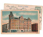
![Ryan Green takes us on a bike ride from downtown Rochester to Fairport. [PHOTO: Ryan Green]](https://www.rochestersubway.com/images/photos/rgbike-erie-canal-path-return-04.jpg)


